
Obubra was established as a British colonial district in 1902 and has evolved over time in both geography and administrative structure. Following the 1976 local government reforms in Nigeria, it was formally designated as Obubra Local Government Area. Today, it stands as one of the older Local Government Areas in Nigeria.
It is located between latitude 4°45’ and 6°15’ North of the Equator and longitude 8°12’ East of the Greenwich Meridian. Obubra is bordered to the north by Yala and Ikom Local Government Areas, to the south by Yakurr Local Government Area, and to the west by Ebonyi State. The area covers approximately 1,115 km² and had a population of about 172,543 according to the 2006 census (National Population Commission of Nigeria, 2006). It is situated in the Central Senatorial District of Cross River State, with its headquarters in Obubra town.
The Local Government Area comprises eleven political wards: Ababene, Ofat, Ofodua, Ovonum, Apiapum, Iyamoyong, Ochon, Obubra Urban, Ofumbongha/Yala, Osopong I, and Osopong II. At its inception, its jurisdiction extended to present-day Biase, Akamkpa, Abi, Yakurr, Ikom, and Ogoja Local Government Areas. Over time, administrative restructuring led to the present configuration, which is predominantly inhabited by Mbembe-speaking communities alongside minority ethnic groups such as Yala (Nkum), Ekuri, Isobo, and Izzi. The Mbembe-speaking population is made up of major clans including Adun, Okum, Osopong, and Ofumbongha. In essence, Obubra reflects a culturally diverse and multi-ethnic society.
Obubra also benefited from early contact with Europeans and was designated the headquarters of the Cross River Division by the British in September 1902.
A significant portion of the population is engaged in agriculture as a primary means of livelihood, including farming and fishing, while others are involved in trading and related economic activities. 
While others are engaged in small-scale trading, public and civil service, as well as various forms of self-employment.
The area is endowed with vast fertile arable land and a favourable climate that supports the cultivation of a wide range of food and cash crops. Major food crops grown in the area include yam, cassava, rice, cocoyam,

maize, groundnut, sugarcane, melon, vegetables, and other assorted crops. Cash crops cultivated in the area include cocoa, palm produce, rubber, and coffee. Although agriculture is largely practiced on a small-scale basis, production often reaches commercial levels. This is supported by the presence of small and medium-scale cassava and rice processing industries, which demonstrate the volume of agricultural output in the area. In addition, agricultural development projects such as the Ochon Oil Palm Nursery, Obrenyi Cocoa Estate, and several privately owned oil palm plantations contribute to the expansion of cash crop production.
Natural Resources and Endowments
Obubra is richly endowed with natural resources, making it one of the notable local government areas in Cross River State. Its forest resources include valuable timber species such as Iroko, Mahogany, Gmelina, Obeche, Opepe, and Cedar. These timber resources are widely used in the construction industry and are supplied not only within the locality but also to neighbouring states such as Benue, Ebonyi, Akwa Ibom, Enugu, and Abia.
In addition to forest resources, the area also has mineral deposits, including lead ore found in Eja and Ogurude, salt deposits located in Ibine-Ababene near the former School of Agriculture, Iyamitet, as well as sand and gravel deposits spread across several communities. Sand deposits stretch from the Ogurude axis of the Cross River through Apiapum, Ofatura, Ovonum, up to Adun beach, while gravel is found along the Apiapum–Obubra road and other locations within the area. However, some of these mineral resources are yet to be fully developed.
Capacity Building
Due to early contact with Europeans, Obubra has a long-standing history of educational development, with institutions established across all levels of learning. The first primary school, PCN Primary School Apiapum, was established in 1920, while the first secondary school, St. Brendan Secondary School Iyamoyong, was established in 1961. Today, Obubra is home to over 73 primary schools and more than 20 secondary schools, producing a steady stream of school leavers and graduates annually. The area also hosts tertiary institutions such as the Faculty of Agriculture of the Cross River State University (UNICROSS) located at Ovonum, as well as privately owned institutions like Elder Oyama Memorial College of Education, Ofat.
Enabling Macroeconomic Environment
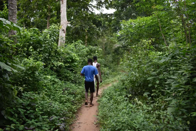
Obubra benefits from a generally stable and supportive environment for socio-economic activities. It is served by key infrastructure such as road networks, electricity supply, water access, and financial institutions. While electricity has reached several communities, expansion is ongoing to cover more areas. Road infrastructure includes major routes such as the Ikom–Calabar Highway, the Apiapum–Obubra Road, and the Iyamoyong–Iyamitet Road, which are tarred, while many other roads are still developing.
Financial services are provided by institutions such as First Bank Plc (Mile 1, Obubra), Polical Community Bank (CRUTECH, Ovonum), Nigerian Agricultural Cooperative and Rural Development Bank (Apiapum), and Ekondo Microfinance Bank (Ogada II), which support economic activities within the area.